


Indonesia’s longest river, the Kapuas in Kalimantan, begins in the foothills of the Muller Mountain Range, snakes for 1,143km, and then flows west into the South China Sea, creating an extended marshy delta along the way.
It passes through some of Kalimantan’s oldest longhouse communities, such as Danau Sentarum and Bukit Raya. Jungle trekking can be enjoyed in the upper areas of the Kapuas River, including a climb of Mount Kelam.
Near the northern shore of the Kapuas River lies a system of lakes which are connected by numerous channels. When the monthly precipitation exceeds about 300mm, the river overflows its banks, diverting much of its water to the lakes and forming a single volume of water. This outflow promotes fish migration from the river to the lakes for spawning.
About 300 species of fish have been identified in the river basin, of which 234 are of high economical value. Among the economically important species are edible fish such as Pangasius catfish, giant gourami, kissing gourami, snakeheads and large barbs; as well as species from the aquarium trade such as the super red arowana and rasboras. Because of overfishing and habitat degradation, several species are threatened. Apart from fish, there are numerous crabs, prawns, water striders and other aquatic insects. Abundant fruits and seeds enter the river after falling from large trees which bend over its waters. Otters and crocodiles are common in the Kapuas River, but sadly, frogs are on the decline.
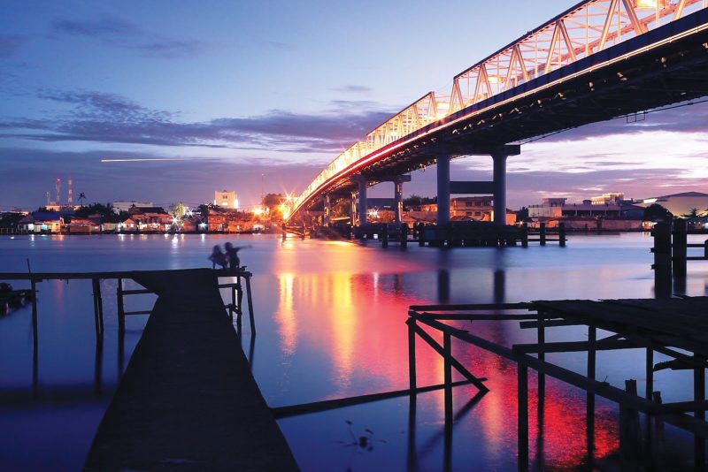
Mountains in the upper Kapuas include Betung, Uluselua, Harung and Piabung. About 800 km upstream lies Putussibau, the last small town which can be reached by large boats. From there only smaller boats can take tourists further to the last village, Tanjung Lokan. It takes approximately two days to reach the Upper Kapuas River, or one day by chartered speedboat. The delta is located west-southwest of Pontianak, the capital of West Kalimantan province. Pontianak has houses built over the waterline, connected to each other by wooden bridges. Many tourists are drawn to local villages, a Dayak longhouse is found at Melapi village, and stone axes from prehistoric times can be seen in Naga Belang.
The term “Dayak people” includes over 200 riverine and hill-dwelling ethnic subgroups, located principally in the central and southern interior, each with its own dialect, customs, laws, territory and culture. Kalimantan tour specialists offer Dayak Longhouse Tours for those who want to experience indigenous cultures. They trek deeper into the forest for an immersive, overnight stay with a local family in their traditional longhouse. From Bengkayang, you can travel into the hinterland and meet the Bekati (Dayak) people.
The indigenous Dayak settlements of Kalimantan warmly welcome guests and it’s an ideal way to experience this ancient culture of traditional medicine, intricate body tattoos and heavy ear adornments, and to experience waterfalls surrounded by dramatic scenery. An inscribed stone is found in the Nangmahap district, near Pahit, on the Tekaret river. It is believed to date from the fifth century and bears a relief of the “phallus symbol” as well as inscriptions in Palawa script, proclaiming some of the tenets of Buddhism.
The historical tomb Juang Mandor is another historic site in the sub-district of Mandor, Landak District. The location was a place of slaughter – approximately 21,000 people died at the hands of Japanese soldiers between 1943 and 1944. On the way back to Pontianak rice paddies and plantations are abundant. Rubber, rice and other agricultural products are important smallholder crops and a source of rural income in the area.
Pontianak is the capital city of West Kalimantan province and this is where tourists can find the Equatorial Monument. Pontianak distinguishes itself as the only city in the world that sits on the imaginary line called the equator, separating the earth’s northern and southern hemispheres. Standing just two miles north of the city centre the monument was first marked by an arrow on a pole by a Dutch geographer in 1928. Due to constant global shift, the monument no longer lies on the exact line of the equator. In 2005, the true equatorial line was recorded a short distance south and, according to GPS readings, the line continues to move south. Despite this, the city of Pontianak holds a party each year during the time of the spring and autumn solstices as the “shadowless sun” reaches its zenith on the Vernal Equinox (March 21 to 23), and the Autumnal Equinox (September 21 to 23).
Alun-Alun Kapuas Park is a pleasant place to have a cooling drink at the end of your journey. This popular city park along the Kapuas River features esplanades around a monumental central fountain. This is a great spot for viewing the river or just for a picnic with your family as it livens up in the cool of the evening. In the afternoon around 5pm, the food vendors start to arrive and set out their stalls. Check out the food stalls or cruise up and down the river while people-watching. Try out one last experience at the mouth of Kapuas River at nightfall by taking a fun motorboat ride and having dinner on board. The colourful neon bulbs adorning the top of the motorboat illuminate your Sungai Kapuas experience.